
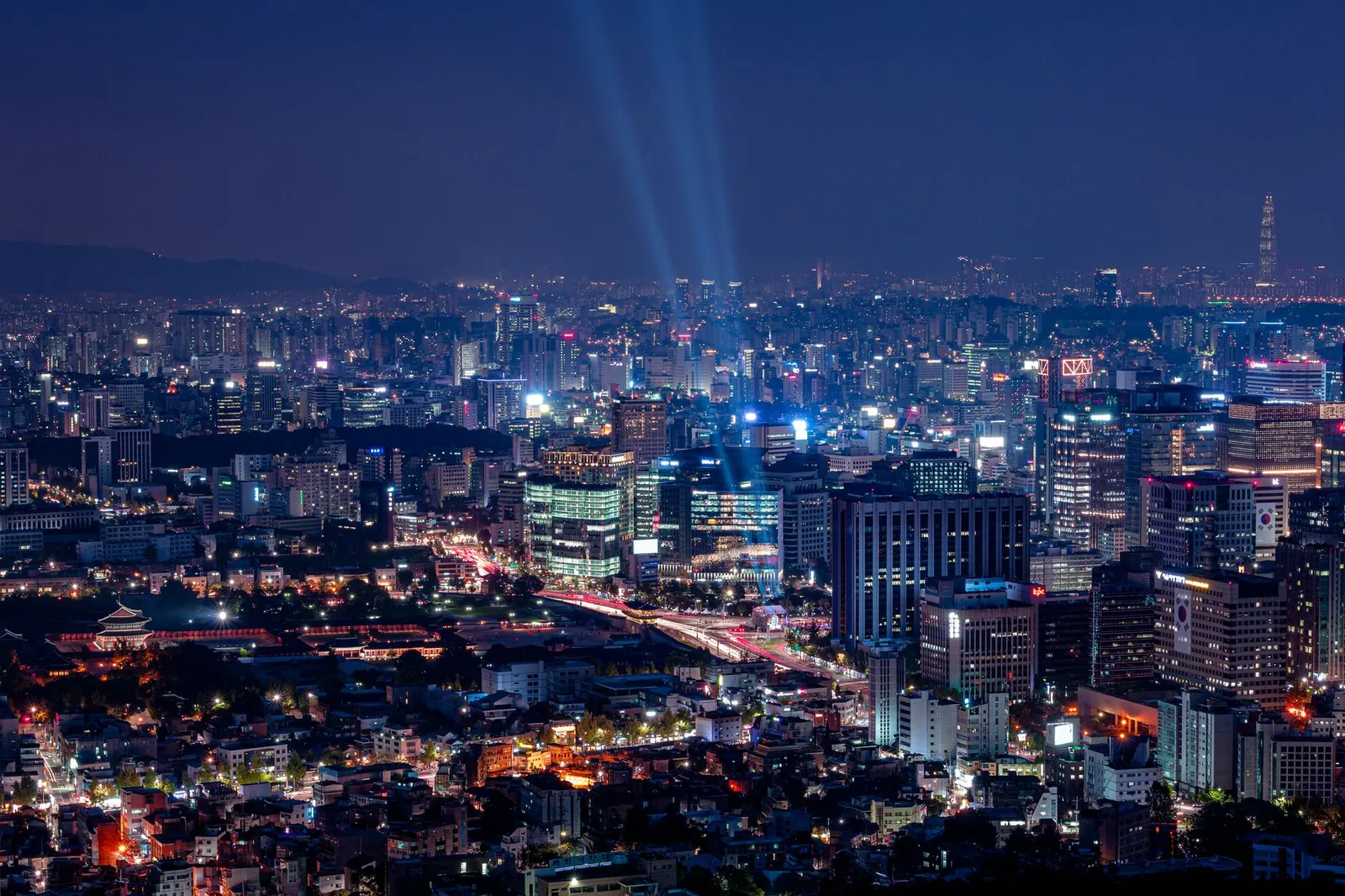
 Seoul by night from Namsan, with searchlights over the cityPhoto: Gije Cho / Pexels
5 days in Seoul: Food & markets
5 days of food & markets, built around the places foreign visitors rate highest and grouped by neighbourhood so you're never criss-crossing the city. Day 1: A day of eating. Day 2: Markets, Myeongdong & Namsan. Day 3: Mangwon, Yeonnam & Hongdae. Day 4: Museums, Itaewon & Hannam. Day 5: Seongsu & the Han River. Every stop is on the map, with Naver and Google links and transit directions between stops.
Every stop, day by day
Pins mark neighbourhoods, landmarks and markets — not specific businesses. Dashed lines show the order, not the walking path; use the "Transit to next stop" links for real directions. Google Maps doesn't do walking directions in Korea — use Naver Map for those.
Day 1 · Seochon → Jongno → Euljiro
A day of eating
Five meals and snacks, west to east through the old city: a coin lunch box, a hanok café, Seoul's most famous market, whole-chicken hotpot and beer under the neon.
-
10:30
1Tongin Market 통인시장
Buy brass coins and fill a lunch box from the stalls. Try gireum tteokbokki.
Nearby: Seochon alleys · Sejong Village Food Street
Read: Seoul's Traditional Markets, Compared ↗ - 2.4 km · subway, bus or taxiRoute in Naver Map
-
13:00
2Ikseon-dong 익선동
Coffee and pastries in a converted 1920s hanok.
Nearby: Insadong tea houses · Nakwon Arcade
Read: Insadong and Ikseon-dong: Old Seoul, Two Ways ↗ - 1.2 km · about 17 min on footRoute in Naver Map
-
15:00
3Gwangjang Market 광장시장
Bindaetteok, mayak gimbap and yukhoe at the food stalls. Share across stalls.
Nearby: Vintage market upstairs · Cheonggyecheon Stream
Read: Gwangjang Market: What to Eat and How to Order ↗ - 600 m · about 8 min on footRoute in Naver Map
-
18:30
4Dakhanmari Alley 동대문 닭한마리골목
Whole chicken simmered at your table, noodles to finish.
Nearby: Heunginjimun Gate · DDP
Read: Dongdaemun, DDP and Euljiro: Seoul After Dark ↗ - 1.6 km · about 21 min on footRoute in Naver Map
-
20:30
5Euljiro beer alley 을지로 노가리골목
Plastic stools, cold beer and dried pollack in the printing alleys.
Nearby: Euljiro's hidden bars
Read: Dongdaemun, DDP and Euljiro: Seoul After Dark ↗
Day 2 · Namdaemun → Myeongdong → Namsan
Markets, Myeongdong & Namsan
An easy central day that works well on arrival: Seoul's biggest traditional market, K-beauty and street food in Myeongdong, then sunset from the tower.
-
10:00
1Namdaemun Market 남대문시장
Seoul's biggest traditional market — hotteok stalls and a noodle alley.
Nearby: Sungnyemun Gate · Kalguksu alley
Read: Seoul's Traditional Markets, Compared ↗ - 1.1 km · about 14 min on footRoute in Naver Map
-
12:00
2Myeongdong 명동
Money changers first, then K-beauty with your passport for tax refunds.
Nearby: Olive Young flagships · Brand flagship stores
Read: The Myeongdong Beauty Crawl ↗ - 250 m · about 4 min on footRoute in Naver Map
-
14:30
3Myeongdong Cathedral 명동성당
A calm Gothic-style cathedral in the middle of the shopping streets.
Nearby: Myeongdong street food (from 5pm)
Read: The Myeongdong Beauty Crawl ↗ - 1.0 km · about 13 min on footRoute in Naver Map
-
16:30
4Namsan Cable Car 남산케이블카
Ride up before the sunset queues — or walk the trail.
Nearby: Namsan Park trails
Read: N Seoul Tower at Sunset: How to Time It ↗ - 1.2 km · about 16 min on footRoute in Naver Map
-
17:30
5N Seoul Tower N서울타워
Sunset from the deck, love locks, city lights.
Nearby: Palgakjeong Pavilion · Namsan circular road
Read: N Seoul Tower at Sunset: How to Time It ↗
Day 3 · Mangwon → Yeonnam-dong → Hongdae
Mangwon, Yeonnam & Hongdae
The young, creative west side: a local market, a riverside picnic, the park on an old railway line, then Hongdae's buskers, karaoke and clubs.
-
11:00
1Mangwon Market 망원시장
A local market with cheap croquettes, fried chicken and snacks.
Nearby: Mangridan-gil cafés
Read: Seoul's Traditional Markets, Compared ↗ - 900 m · about 12 min on footRoute in Naver Map
-
13:00
2Mangwon Hangang Park 망원한강공원
Eat your market haul by the river.
Nearby: Bike paths
- 3.1 km · subway, bus or taxiRoute in Naver Map
-
15:30
3Yeonnam-dong 연남동 경의선숲길
Cafés and people-watching along the Gyeongui Line Forest Park.
Nearby: Yeontral Park lawns
Read: Hongdae After Dark ↗ - 1.3 km · about 17 min on footRoute in Naver Map
-
18:00
4Hongdae street performances 홍대 걷고싶은거리
Buskers and K-pop dance crews from early evening.
Nearby: Chimaek pubs · Themed cafés
Read: Hongdae After Dark ↗ - 650 m · about 9 min on footRoute in Naver Map
-
21:00
5Hongdae after dark 홍대입구역
Noraebang, bars and clubs. Plan your ride home — the subway stops around midnight.
Nearby: Coin karaoke · Sangsu cocktail bars
Read: Hongdae After Dark ↗
Day 4 · Yongsan → Itaewon → Hannam
Museums, Itaewon & Hannam
A world-class free museum in the morning, then Seoul's most international neighbourhood — halal lunch, design shops in Hannam and a relaxed night out.
-
10:00
1National Museum of Korea 국립중앙박물관
Gold crowns, celadon and a stone pagoda indoors — free permanent collection.
Nearby: Mirror Pond · War Memorial of Korea
Read: Rainy Day in Seoul: 15 Things to Do Indoors ↗ - 2.4 km · subway, bus or taxiRoute in Naver Map
-
13:00
2Itaewon & Usadan-ro 이태원 우사단로
Lunch from anywhere in the world; halal options near the mosque.
Nearby: Seoul Central Mosque · International groceries
Read: Itaewon, Block by Block ↗ - 700 m · about 9 min on footRoute in Naver Map
-
15:00
3Hannam-dong 한남동
Design shops, galleries and the Leeum Museum of Art.
Nearby: Leeum Museum of Art
Read: Itaewon, Block by Block ↗ - 1.6 km · about 22 min on footRoute in Naver Map
-
17:30
4Haebangchon 해방촌
Hillside bars with sunset views toward Namsan.
Nearby: Namsan trails
Read: Itaewon, Block by Block ↗ - 1.6 km · about 22 min on footRoute in Naver Map
-
20:00
5Itaewon nightlife 이태원역
Bars and clubs with an international crowd.
Nearby: Gyeongridan-gil
Read: Itaewon, Block by Block ↗
Day 5 · Seoul Forest → Seongsu → Ttukseom
Seongsu & the Han River
Seoul's coolest neighbourhood: a park morning, warehouse cafés and brand pop-ups, then sunset by the river.
-
10:30
1Seoul Forest 서울숲
Lawns, ginkgo paths and a deer enclosure — the slow start.
Nearby: Seoul Forest café streets
Read: Seongsu, Mapped: Seoul's Coolest Neighbourhood ↗ - 2.1 km · subway, bus or taxiRoute in Naver Map
-
12:00
2Seongsu café streets 성수동 카페거리
Brunch and coffee in converted factories — stick to the side streets.
Nearby: Yeonmujang-gil · Handmade shoe street
Read: Seongsu, Mapped: Seoul's Coolest Neighbourhood ↗ - 550 m · about 8 min on footRoute in Naver Map
-
15:00
3Seongsu pop-up streets 성수역
Brand pop-ups and concept stores north of the station. Weekdays are calmer.
Nearby: Concept stores · K-beauty pop-ups
Read: Seongsu, Mapped: Seoul's Coolest Neighbourhood ↗ - 2.7 km · subway, bus or taxiRoute in Naver Map
-
18:00
4Ttukseom Hangang Park 뚝섬한강공원
Sunset picnic — chicken or convenience-store ramyeon by the river.
Nearby: Ramyeon machines · Bike rental
Read: The Han River Night Picnic ↗
- Late nights: the subway stops around midnight. Plan a taxi or night bus home, or stay near where you go out.
- Where to stay: Myeongdong & Hongdae is the easiest base — compare the areas in our where to stay guide. Wherever you are, a Climate Card makes the subway unlimited.
- Swap days freely. Each day is a self-contained neighbourhood loop — rain day? Move the outdoor day and see our rainy-day plan.
DDP, the city wall & Euljiro nights
A late-starting afternoon-into-night: Zaha Hadid's DDP, the old east gate, a free night view from the city wall, whole-chicken hotpot and Euljiro's hidden bars.
Read the guide →Day trip: Suwon Hwaseong Fortress
A UNESCO-listed 18th-century fortress wall you can walk around, a restored palace, and Suwon's famous fried-chicken street.
Read the guide →Every pin in your map
150 places near these stops, with Naver links and a Google My Maps file.
The map pack →Start over
Pick a different number of days or a different style.
Trip planner →